")
")
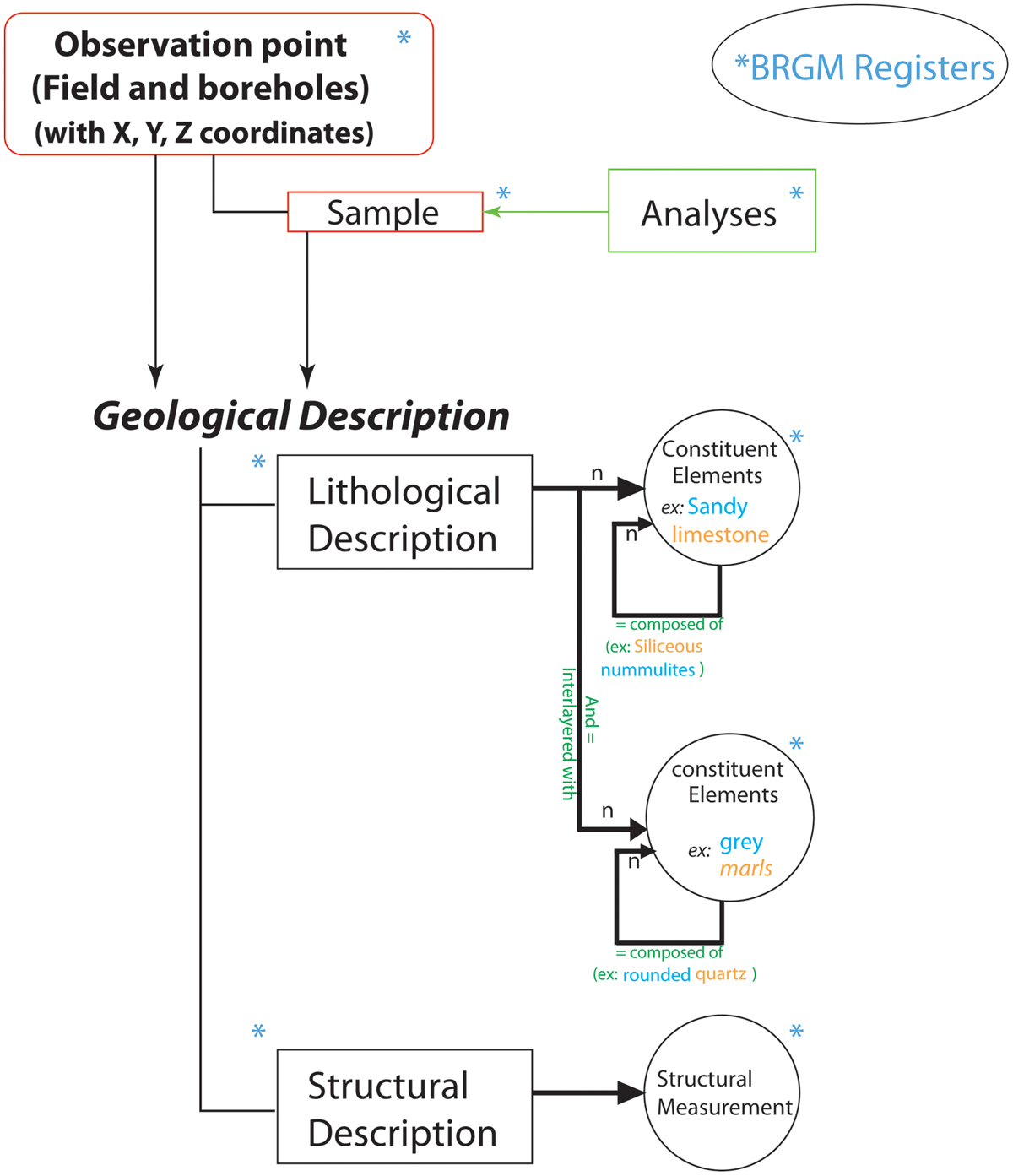
Fig. 3
Download original image
Diagram showing relationships between observation points and the geological description in the GEOFIELD application. The in-house Geofield application makes it possible to manage data from field observations and measurements, rock sampling, and even laboratory analysis. Each geological feature is described by a list of terms from the BRGM registers that are standardized and common to different BRGM applications, are designed to be compatible with European and international standards (GeoSciML and INSPIRE standards).
Current usage metrics show cumulative count of Article Views (full-text article views including HTML views, PDF and ePub downloads, according to the available data) and Abstracts Views on Vision4Press platform.
Data correspond to usage on the plateform after 2015. The current usage metrics is available 48-96 hours after online publication and is updated daily on week days.
Initial download of the metrics may take a while.