")
")
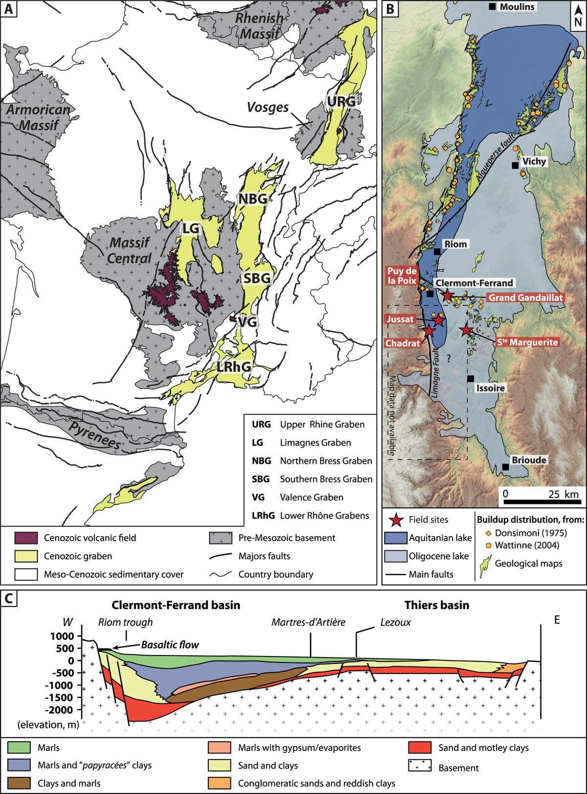
Fig. 1
Download original image
A. Structural map of the western part of the European Cenozoic Rift System, a succession of (half)grabens extending from the Mediterranean Sea to the Bohemian and Rhenish Massifs (after Dèzes et al., 2004 and BRGM, 2006). B. Map of the Limagne Basin showing the main study site and their relation with the paleogeographic extensions of the lake during the Oligocene and Miocene (adapted from Hugueney et al., 1999) and distribution of the buildups. The base map corresponds to the Digital Elevation Model over Europe from the GMES RDA project (EU-DEM). C. Geological E-W transect of the Central Limagne (after Morange et al., 1971; Wattinne, 2004).
Les statistiques affichées correspondent au cumul d'une part des vues des résumés de l'article et d'autre part des vues et téléchargements de l'article plein-texte (PDF, Full-HTML, ePub... selon les formats disponibles) sur la platefome Vision4Press.
Les statistiques sont disponibles avec un délai de 48 à 96 heures et sont mises à jour quotidiennement en semaine.
Le chargement des statistiques peut être long.